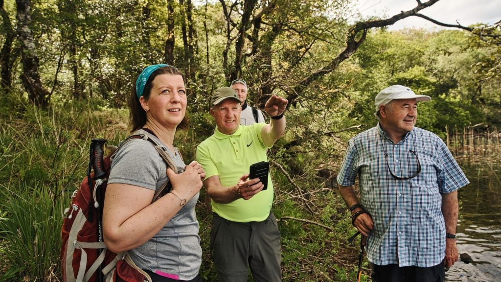
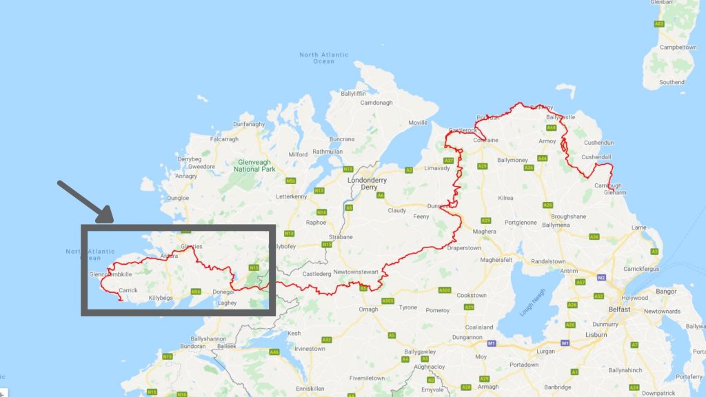
Stretching across 279 miles from the spectacular cliffs of Slieve League in Donegal to the rolling hills of Antrim and Larne on the east coast of Ulster, there is so much to see and do along the International Appalachian Trail Ulster-Ireland. To help you plan your perfect IAT Ulster-Ireland adventure, we have pulled together a series of blogs that share the top things to see and do section by section. In this blog we share with you the must visit locations in Donegal. One of the beauties of this corner of Donegal is that you can visit a number of brilliant natural attractions without having to drive for longer than 50 minutes.
Don’t forget to share your Donegal IAT Ulster-Ireland adventures with us on social media using #IATUlsterIreland.
Slieve League

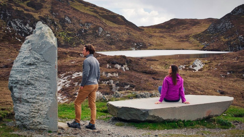
A visit to Slieve League is definitely one of the Bucket List activities for those visiting Donegal. Situated on the West coast, the cliffs are said to be the highest and one of the finest marine cliffs in Europe with a three hundred metre drop straight down into the wild, Atlantic waves below. This creates a breathtaking but extremely scary view. We recommend stopping by the visitor centre when you arrive to find out some more about this area and pick up a souvenir. We advise you to park at the first car park and walk to the viewpoint and information centre to avoid the traffic congestions especially during peak summer seasons.
Be sure to check out the ‘Sliabh Liag Experience’ within the Visitor’s Centre, which includes a Cafe and seating area, there are interpretation panels entitled ‘On the Edge’ to experience the beauty and stories of Sliabh Liag which also incorporates some interactive play for younger visitors. An external wider interpretation of Sliabh Liag includes beautifully crafted story stones, each one depicting artistic illustrations which animate the main themes about the mountain and echo the narrative which you will have experienced in the Visitor Centre.
From the viewpoint the choice is yours – you can soak in the views from this point or follow the trail further along the cliffs, we only recommend those who do so are confident walkers with a good level of fitness. It is from here that more adventurous climbers can follow the Slieve League One Man’s Path along the IAT Ulster-Ireland. Care should be taken.
Pints and folklore at Evelyn’s Central Bar
This homely bar, located in Carrick is right on the road to the Slieve League Cliffs. A great place to come in to chat to locals and learn a great deal about the area and old folklore stories. Traditional and contemporary music is played every night from Thursday to Sunday. The bar offers a huge range of beverages, alcoholic, non-alcoholic and Irish whiskeys/coffees often made with the local legendary Irish whiskey Silke from the local distillery. Opening hours: Mon- Thu: 10:30am – 11:30pm, Fri & Sat: 10:30am – 12:30 am, Sun: 12:30pm – 11pm
Pick up a local souvenir from Sliabh Liag Distillers
If you want to find out more about the local whiskey you enjoyed during your visit to Evelyn’s Central bar, plan a visit to Sliabh Liag Distillers, the first distilling company in the county for over 175 years, established with the purpose of reclaiming the distilling heritage of Donegal. Located on the Sliabh Liag peninsula, the two distilleries are surrounded by one of the world’s most striking landscapes populated by resilient people, steeped in folklore and with a legendary distilling heritage. Tours available: www.sliabhliagdistillers.com
Get a higher perspective of Slieve League from the Pilgrim’s Pass
Cosán an Oilithrigh or Pilgrims Path at Slieve League is a stunning 4km access route on to the plateau of the cliffs. It follows the ancient path up a U-shape valley nestled between Leargadachtan Mountain and the sea cliffs at Shanbally, overlooking the small fishing village of Teelin. Up on top of Sliabh Liag is the early Christian monastic site of Aedh McBric’s Church and Well. There are also the ruins of the monk’s stone dwellings (bee hive huts).
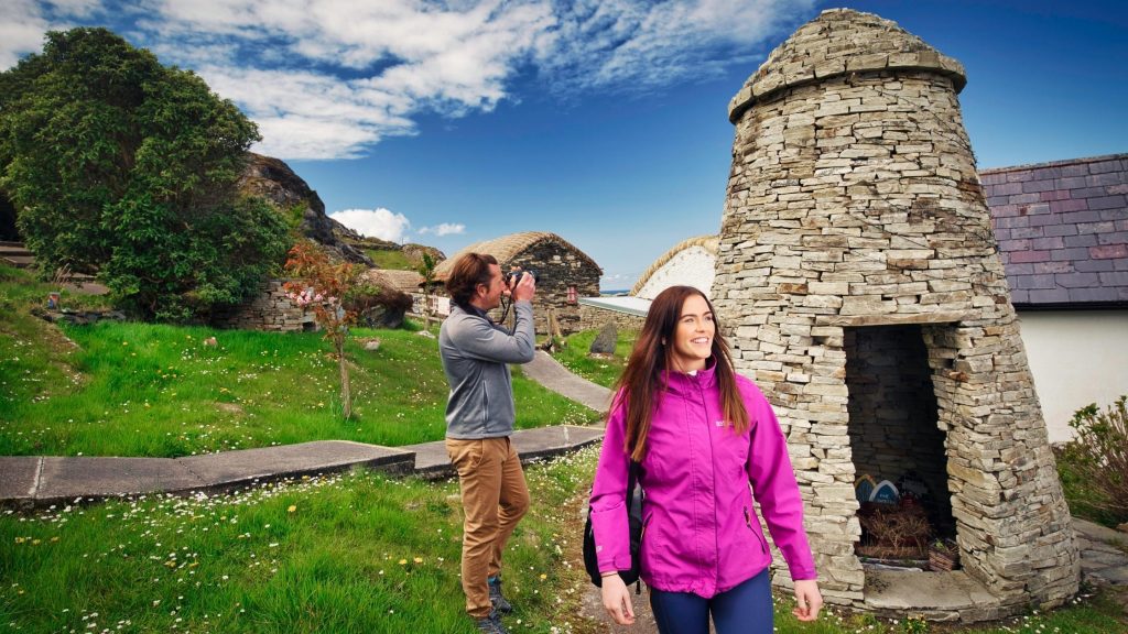
Glencolumbkille Folk Village
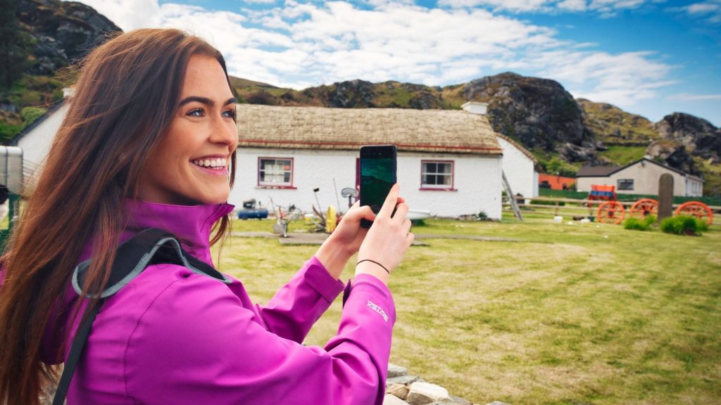
Perched overlooking the idyllic Glen Bay Beach, a worthwhile stop is Glencolumbkille Folk Village which offers a glimpse into what daily life was like in Ireland in the past. This thatched-roof replica of a rural Irish village is an exact replica of a dwelling from the 18th, 19th and 20th centuries. Wander through the village at your leisure or take a guided tour.
Most visitors here tend to opt for the excellent Glencolumbkille Folk Village tour, which offers a unique insight into how people lived, cooked, slept, worked and stayed warm during what were harsh and challenging times for many. For those with ancestry tracing back to Ireland, this can provide a unique look at how their forefathers lived.
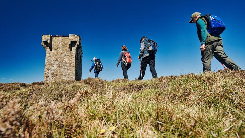
The walk to Glen Head Signal Station
The signal station at Glen Head is located on a cliff edge site that is accessed via a long lane that leads out of Glencolumbkille, which begins at the important early monastic site. The site has extensive views to the west and the signal tower at Malin Beg Signal Station to the south west and the location of a badly eroded signal station at Dawros Head to the north east, are clearly visible.
The unenclosed signal station at Glen Head features a largely intact signal tower which features the usual arrangement of a seaward facing first floor doorway. All but one of the windows retain their dressed stone surrounds except for one of the ground floor windows on the north east wall. Unfortunately the inside of the tower cannot be explored due to structural damage. From here you can make your way closer to the cliff edge where you will find the foundations of two small buildings to the north of the tower. It is not clear if these are contemporary elements of the signal station although they are similar in form to other building foundations found at a number of the enclosed signal stations where the association is more obvious.
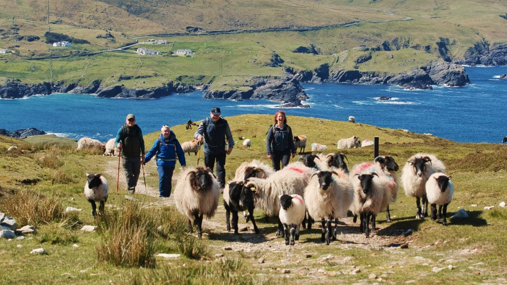
Glengesh Pass
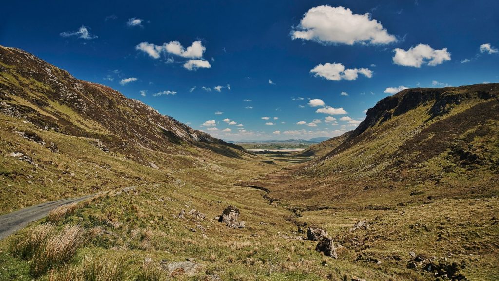
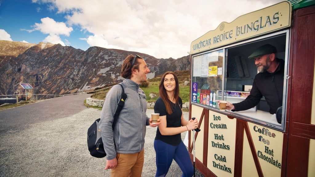
On your way from Slieve League to Maghera Beach discover the jaw-dropping views of Glengesh Pass. Glengesh (which means ‘Glen of the Swans’) is a high mountain pass that cuts through the Glengesh and Mulmosog mountains and links the towns of Ardara and Glencolumbkille. A lookout area on the Ardara side offers walkers the opportunity to enjoy a picnic overlooking the Pass and the Atlantic Ocean. There is space here for about 6 or 7 cars and a coffee cart can often be found here, ideal for weary walkers in need of a quick pick-me-up.
There is something incredible about the walking experience you will have as you make your way down this Pass following the road as is weaves its way down towards the ocean. You are sure to encounter a number of sheep as you make your way down through the Pass. Please think careful about where you are walking if you want to climb higher for a better view and be sure to practice the principles of Leave No Trace.
Stop for a Guinness at Nancy’s of Ardara
Now in its seventh Generation of ownership, Nancy’s Bar is famous for its Guinness and Nancy’s for world-renowned Seafood, Music and Craic Irish Coffees. They are members of the Irish Seafood Circle for the last 2 years. Location: Front Street, Ardara, Co Donegal
Maghera Beach and Caves
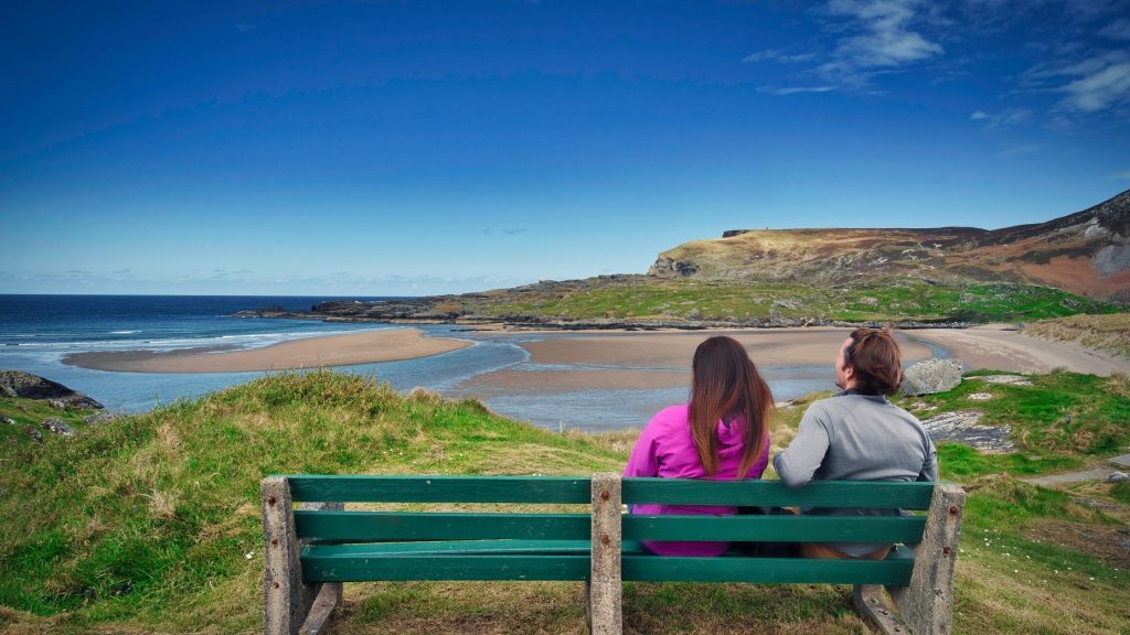
Located just 16 minutes by car from the vibrant village of Ardara enjoy almost 5km of white sandy beach when the tide is out. The road to the beach is narrow, but there are places to pull over if needed. The car park is run by a local who charges a very reasonable price to park and help maintain the pathways.
This is arguably one of the most impressive and stunning beaches in Donegal as you will often find yourself the only visitor there, apart from the sand martins in the cliffs and the Burnet Moths in the sand dunes. The perfect white sand, the deep blue water and the sloping dunes ideal for sheltering from the wind, entice visitors and locals alike to this hidden gem. If you are arriving with the intention to see the Maghera Caves you must be there at low tide. This is extremely important to note as the tide can come in quickly. Do not, under any circumstances, attempt to enter the caves without checking the tide times in advance. The caves can be dark so we recommend bringing a torch. With more than 20 caves, 8 arches and 5 tunnels there’s a lot to see here so be sure to pack a picnic for your adventure. It is likely that people sheltered from Vikings in these caves when they landed in Donegal.
Please note: Swimming on Maghera Beach is not encouraged due to the strong tides and being so remote.
Assaranca Falls
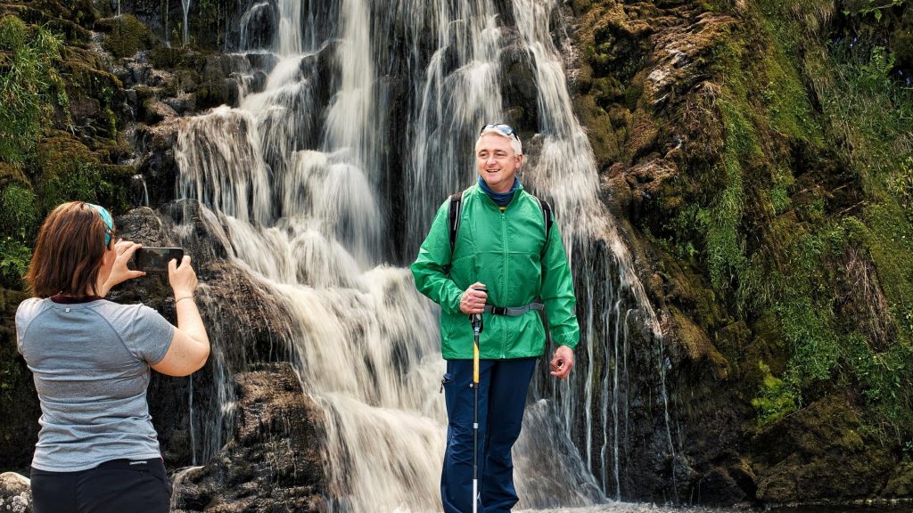
Located 8km southeast of Ardara village near Maghera Strand you will find the wild Assaranca Falls (also known as Eas a’ Ranca taking its name from the Gaelic word Eas which means waterfall). The waterfall is easily accessible as it is literally on the side of the road, so you can’t miss it as your drive or walk past. There is plenty of room to pull over and park during the quieter seasons. The waterfall is impressive to visit at any time of the year but is best during or after rainfall. If you visit while there is heavy rain, you can see the water plummeting down over the hill into the streams below. Pose for your picture in front of the waterfall and tag us on social media using #IATUlsterIreland.
Disert Graveyard Walk
Situated at the foot of the Bluestack Mountains approximately 10km north west of Donegal Town. Disert is the site of an ancient graveyard and a holy well dating to the times of St Colmcille (6th century). Other historic sites here include a mass rock, cairn and a Dolmen. The walking loop around the graveyard is a 2km signposted walk and is suitable for walkers of all levels.
Lough Eske

Located near to Donegal Town the trails around Lough Eske are idea for walkers looking to soak in nature and enjoy the peace and tranquility of the Lough. Boasting some fantastic hotels including Harvey’s Point and Lough Eske Castle this area is ideal for a romantic getaway or weekend away with friends. The hotels also offer refreshment services for walkers looking a bite of lunch, dinner or drinks. We highly recommend checking out the Nature Trail and Famine Pot when in the area.
Famine Pot – Located a short distance from Ardnamona Woods and the shores of Lough Eske, take some time to explore the Famine Pot – a pot used during the Irish Famine (1845 – 1852) to cook basic food for the starving. The pot is housed in a small, protective stone structure.
Ard na Mona Looped Walk – This native oak woodland is perfect for those looking a quite walk in nature. Looped paths will take you past beautiful mosses, bluebells, wood sorrel, streams and the lakeside. The wood is also home to red squirrel, badger, fox and mink. Dogs are allowed if kept on a lead.
Lough Eske Castle Grounds – The grounds of Lough Eske Castle also offer walkers a chance to view castle ruins and a Celtic cross. Lough Eske Castle offer a complimentary daily history tour, commencing each morning from the main reception area. Discover how the famous O’Donnell family built the castle in the late 1400s. Hear the stories of Lough Eske Castle’s past and learn a few fun facts on the history of Donegal.
This really is just a snapshot of some of the wonderful places you can explore on foot in Donegal when you follow the IAT Ulster-Ireland route. Share your own discoveries along this epic trail with us on social media using #IATUlsterIreland.