
Whether you have previously taken some time away from the hustle and bustle of daily life to explore sections of the International Appalachian Trail (IAT) through North America or planning on taking your first steps on this iconic trail, the route of the International Appalachian Trail through Ulster – Ireland really is the next step in your walking Journey
What makes this the largest walking trail in the world? The Appalachian-Caledonian Mountains stretch across the eastern United States and Canada, Greenland, Scandinavia, the British Isles, Brittany, the Iberian Peninsula, and the Anti-Atlas Mountains of Morocco. The International Appalachian Trail now comprises of 23 Chapters on three continents of which the Ulster-Ireland trail is part.
How is the trail connected across continents? The International Appalachian Trail began as a commitment between the U.S state of Maine and Provincial Canada to work together as neighbors to sustain a shared environment and celebrate the grandeur of a common landscape. The Mission of the trail is “Thinking Beyond Borders” to join people and cultures a mission that has since been embraced in Greenland and Iceland and across the arc of the North Atlantic to Europe and North Africa. Together progress is being made to maintain and improve the trail experience working with landowners, hikers, conservation organisations and local, regional, and national governments.
Whether you are looking to build a walk along the International Appalachian trail into your short break or holiday or looking to challenge yourself over a few days or a few weeks by walking much larger sections there is something for everyone to enjoy! A fantastic range of accommodation offerings from camping and self-catering to guest houses and hotels, local guides, and places to eat and drink along the way. Don’t forget to pick up an International Appalachian Trail Ulster-Ireland Buff or pin badge from a local Tourist Information Centre.
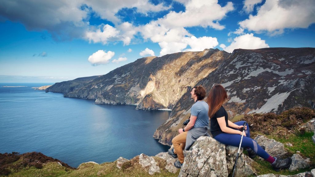
Breathtaking views
The International Appalachian Trail Ulster – Ireland boasts countless opportunities to take in breathtaking views. The official starting point for the Ulster-Ireland trail begins in County Donegal at Sliabh Liag (pronounced Slieve League) where you will feel like you’re at the edge of the world looking out across the Atlantic in the direction of North America. Breathe in the salty sea air and take in the panorama of blue sky and ocean. Look down, and you will see the Atlantic Ocean swirling and crashing onto the rocks below. These cliffs are among the highest sea cliffs in Europe. From the viewpoint. The paths become rocky as you venture further up the, so care must be taken when treading these paths. This challenging journey from Pilgrim’s Path along One Man’s Pass will bring you to the summit of the cliffs where your knees will be shaking as you look down the 609m (1,998ft) drop below! We recommend taking a guided walk which will treat you to insights and stories about the local wildlife and landscapes. From here the trail follows the Blue Stack Way past ancient monuments, folk villages and the peaceful Lough Eske.
Panoramic views and rich biodiversity
Crossing the Ulster – Ireland border at Kelly’s Bridge walkers are in for a treat following this next section of trail through County Tyrone. Even on the days when the Irish weather isn’t being so kind the walk through the woodlands is exceptionally beautiful, as the mist and haze settles over the likes of Loughahull where you can keep a watchful eye out for ‘The Great Diving Beetle’ also known as the ‘Predacious Diving Beetle’. New signage and waymarkers have ben stalled across the entire trail providing lots of information on each area you visit.
The International Appalachian Trail picks up the iconic Ulster Way at the northern slopes of Bollaght Mountain where you will follow quiet country roads, woodland trails and open countryside. The trail continues through Baronscourt Estate to the summit of Bessy Bell.
Considered to be one of the highlights of the area, the ascent of Bessy Bell is a popular walk with local and tourists alike! On the way to the summit, you will pass a Holy Well (Toberneill) which is surrounded in much folklore and stories from days gone by. Bessy Bell boasts a welcoming rounded character, the summit is capped with open moorland of rough grass and heather while the lower slopes feature rural pastures and farmland. As late as the 19th century, Bessy Bell was climbed by local people in early August to pick billberries. The billberry (Vaccinium Murtillus) is a round, flat topped, tiny fruit that grows in the wild on the high ground and in hard-to-reach places.
The summit views here reward you with panoramic views of the western Sperrins before continuing your journey through Gortin Glen Forest Park, around Gortin Lakes and onto the summit of Barnes Gap. With areas such as Gortin Lakes having strong links back to the glacial period you can see this reflected in the nature and landscape of the area as you explore.

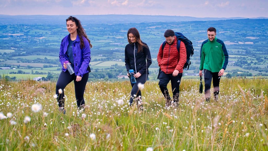
An undisturbed Birdseye view
The trail continues through the Sperrin Mountains which are one of Northern Irelands “Hidden Gem” walking locations. Yet to be explored by the masses, the trail through the Sperrins offers a unique and peaceful journey to a walker. The views from summits such as Eagle’s Rock will have you stopping for a very long tea break as you take in the vast panoramic views. This is a popular walk for hiking groups from the area and it’s easy to see why.
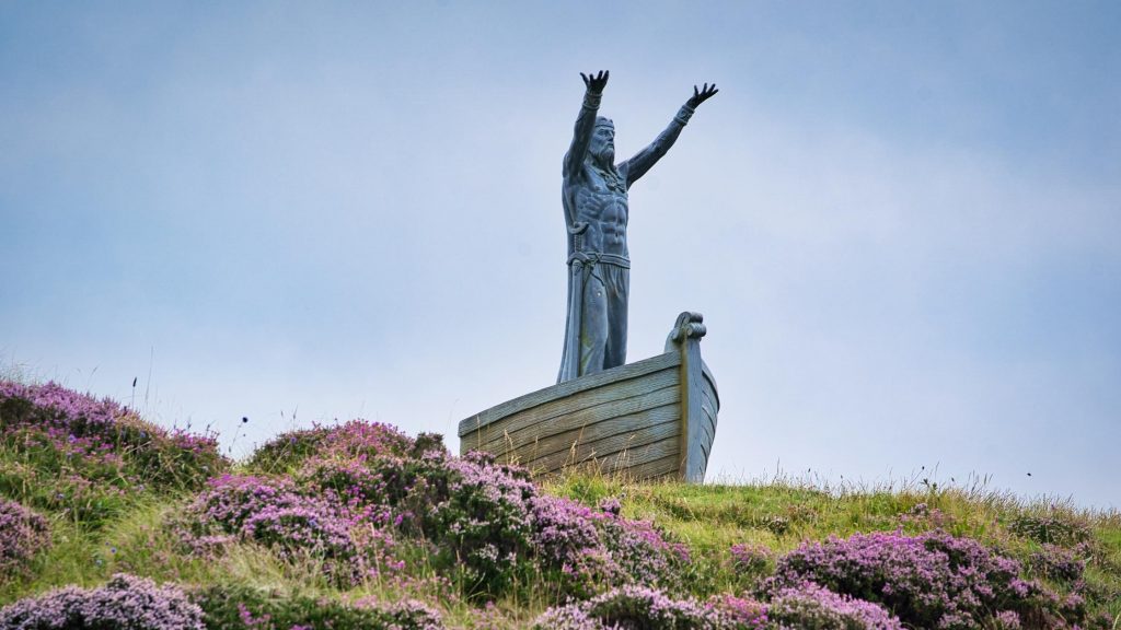
Unlock Ulster-Ireland myth and legend?
The trail through County Londonderry takes you through some fantastic forests and over Glenshane where you can find ‘Ireland’s highest pub’ the Ponderosa. After this point you will begin your ascent of Binevenagh Area of Outstanding Natural Beauty (AONB) where you will meet the famous statue of Manannán Mac Lir as he overlooks Lough Foyle. Manannán Mac Lir (pronounced ‘man-an-on-mack leer’) was the greatest sea-god of Irish Mythology. His name means ‘son of the sea’ and he is regarded as the Overload of the mighty Tuatha de Danann. His famous boat was named Scuabtuinne meaning ‘the wave sweeper’, and was a chariot drawn by the powerful horse ‘Enbarr of the Flowing Mane’, who could travel easily both on sea and land. He used this chariot to transport beings from the mortal world to the Otherworld, of which he was Guardian. Such was the power of the chariot that it obeyed the thoughts of the person aboard and did not require sails or oars. The boat could even grow to accommodate any number of passengers. So don’t get too close!!
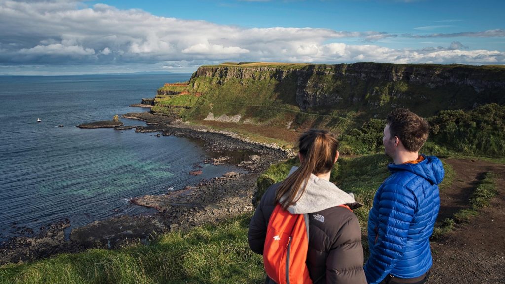
A chance to follow in giant footsteps
From the lofty heights of Binevenagh AONB the trail descends and picks up the famous Causeway Coast. There is much to see and do along the way from exploring white sandy beaches with fossils dating back to prehistoric times, castle ruins on the cliff edge and an opportunity to find out more about the famous Giant Finn McCool whose home was said to be at the famous UNESCO World Heritage Site the Giants Causeway. The Giant’s Causeway lies at the foot of basalt cliffs and is made up of some 40,000 massive black basalt columns sticking out of the sea.
A chance to explore waterfalls and glorious glens before the next Chapter!
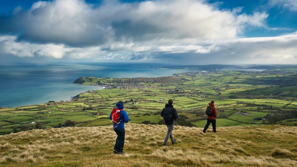
From the rugged northern coastline of Ulster the trail heads south down the eastern coastline. This section of the trail takes walkers through the most glorious glens and hills. Walkers are in for a real treat seeing one of Ulster’s largest waterfalls in Glenariff Forest Park. Also known as the ‘Queen of the Glens’ this location provided spectacular views on a clear day reaching as far as Scotland. A popular walk with many walking groups is the walk up Scawt Hill close to the trails end point in Larne.
We would love to be part of your International Appalachian Trail Ulster-Ireland journey of discovery. Tag us in your IAT moments on social media using #IATUlsterIreland